A 3 Day Kayak Circumnavigation of Saturna Island
Saturna Island lies just off the east coast of Vancouver Island, BC and is one of the least populated of the Canadian Southern Gulf Islands with a permanent population of around 350 people. It is also the most mountainous of the gulf islands and about 31 sq km (12 sq mi) in size. More than half of the island is part of the Gulf Islands National Park Reserve so there is a very remote ‘feel’ to much of the island. So, when I got a call from my brother a couple of months ago telling me he wanted to bring his two teenage boys to the west coast for a kayaking trip, I felt a circumnavigation of Saturna would be ideal.
They are from Cincinnati, OH and with the limited time they had to spend here, we decided that a 3-day trip to the Gulf Islands National Park would be a good fit because of its close proximity to Victoria, BC, where I live. Our father, 83 years old was also going to join us but a torn rotator cuff, sadly, forced his cancellation.
The southern Gulf Islands are a labyrinth of islands and tiny islets surrounded by the waters of the Salish Sea on Canada’s west coast sandwiched between the mainland and Vancouver Island. The area’s mild Mediterranean climate and sheltered waters make it a kayaker’s paradise. Quite a few portions of the Canadian Gulf Islands have been made into one of Canada’s newest national parks, the Gulf Islands National Park Reserve, established in 2003. The park was established to protect some of the unique and beautiful ecosystems found on the islands, islets and reefs located here.
Trip Planning
Even a 3 day, 2 night kayaking trip requires a lot of planning and gear. Meals for 4 people means 2 breakfasts, 3 lunches, 2 dinners, snacks, and drinks. It doesn’t seem like much, but food can make the trip, so you want to do this well and keep those hungry teenagers happy!
You also need to find out where you are going to be able to camp, where to get out on shore for breaks, what are the interesting sites or short hikes that you may want to see.
You also need to consider that the eastern edge of Saturna Island is exposed to the Georgia Strait, which is the large body of water lying between Vancouver Island and the mainland coast of British Columbia and the northern part of Washington State. It is approximately 240 kms (150 mi) long and varies in width from 20 to 58 kms (12 to 36 mi). So it represents as significant risk in terms of exposure to adverse northerly and southeasterly winds so checking the weather and having a back up plan just in case is essential.
There are also significant currents that get pushed through the channels between the islands and around headlands, which can also pose a significant risk to unwary or inexperienced paddlers. Fast moving water creates eddies and eddylines, which are the transition line between water moving in opposite directions. Crossing these eddylines unaware can quickly capsize a kayaker.
All of this makes it critical to check the nautical charts of the area to find out where those high-risk areas are and then check tide and current tables to see what the predicted flows are going to be. Finally the winds need to checked to see where and when there may be a conflict between the two. Wind against current means larger, steeper waves.
Departure for Saturna Island
The weather can really throw a wrench into the works, particularly if you are on a limited time schedule, and it did just that for this trip. The day of our planned departure had winds forecast to reach 40 knots (75 kph or 46 mph), forcing us to delay our departure for a day. Fortunately for us the next 3 days looked ok, allowing us to continue with our plans, so we loaded all the gear in the truck and headed off to catch a ferry.
The BC Ferries south island ferries leave from the same terminal as the mainland ferries at Swartz Bay on the northern tip of the Saanich Pennisula, about 30 minutes from downtown Victoria. Our ride to Saturna Island on the Mayne Island Queen was a direct run taking about 1 ½ hours.
Getting on the Water – Lyall Harbour to Cabbage Island
We had two kayaks of our own available for our trip so we needed 2 more boats for Nick and Eric. This is another reason Saturna Island was a great choice for this trip. The Ocean River Sports Saturna Kayak Shack is located right at the BC Ferries terminal at Lyall Harbour, so all we had to do was drive off the ferry unload the gear, grab a couple of boats, load up and set off.
Note: Sadly, Ocean River has closed the Saturna Kayak Shack, but you can still rent boats from their facilities in downtown Victoria or Oak Bay. You can contact them at their website: Ocean River. You can, however, still launch your kayaks from the Government Dock in Lyall Harbour.
Kayak Rentals on Saturna Island: You can rent kayaks and take courses from Kayaking Skills.com located in Lyall Harbour: Kayaking Skills.com
Unless you have the luxury of a trial packing of your kayak before you leave, the first loading is always a little frantic and chaotic. Looking at the mound of gear sitting on the dock generally leaves you wondering if there is anyway that it is all going to fit.
As it turns out we had tons of room and once the kayaks were loaded the boys were given a quick lesson on getting into their kayaks safely. When I was instructing kayaking we jokingly made sure our students were given 3 rules to remember so that in the event they forgot everything else they were taught, they could still look like they knew what they were doing, at least to the average onlooker.
The rules were: 1) Don’t call your nautical chart a map…that’s a dead give away you’re not a mariner. 2) Make sure your paddle isn’t upside down. Most sea kayaking paddle blades are asymmetrical, the cut out edge of the paddle enters the water first. Paddling with your paddle upside down is another sure give away that you haven’t a clue. 3) Make sure you use good technique getting in and out of your kayak. (This one is actually quite serious). The most likely place you will capsize and the most likely to be seen and thus, the most embarrassing, is getting in and getting out of the kayak on shore or the dock. You need to learn a good technique to maintain good stability.
Food is always a tough one, what to bring and how much? However, large sea touring kayaks make it far easier than bicycling or backpacking as you have a lot more room and weight isn’t as much of a consideration, especially on shorter trips. Good food always makes a trip more enjoyable and there is the social aspect of food preparation and having a meal together.

Lunch Stop on Curlew Island in Horton Bay – Pita pockets, fresh veg, lunch meat, mustard & mayo and some of my Mom’s homemade date squares for dessert!
Our route took us across the bay to the channel between Mayne and Samuel Islands, where we had a quick stop for lunch on Curlew Island. From there we wanted to cross out to the Belle Chain Islets which are just off the coast in the Georgia Straits. There is generally a lot of sea life along these small islets including harbour seals, sea lions, bald eagles, cormorants, black oyster catchers etc.
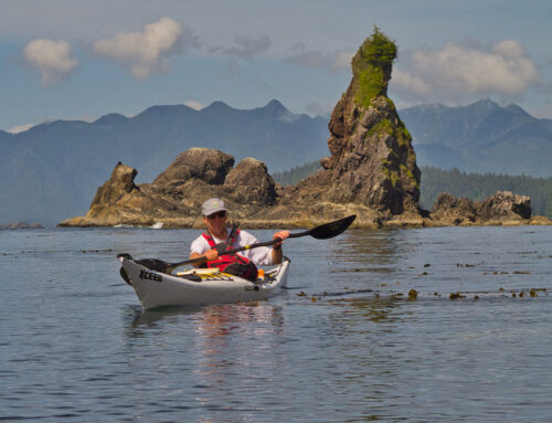
While conditions were quite good, the wind and current created a bit of wave action as we followed the Belle Chain Islets towards Cabbage Island. There were also some breaking waves over the shallow reefs found along there. This can be great fun for experienced kayakers and while Nick and Eric lacked experience, their youthful exuberance and natural abilities kicked in and they had some great fun trying to catch the waves. Murray and I kept a close watch on them though!
From the Belle Chain Islets we headed east along Saturna, heading directly for Cabbage and Tumbo Islands, Cabbage being our final destination and the Gulf Island National Park Reserve (GINPR) campground that we would be staying at.

An interesting transition zone – the silty grey-green water is from the outflow of the Fraser River on the mainland side of Georgia Strait
Cabbage Island
Cabbage Island is only about 4.5 hectares but it has large sandy beaches and gorgeous views. There are no hiking trails on the island, but it is easy to circumnavigate, something we did in the evening, taking in the spectacular early evening views across the Georgia Straits and the spectacular sunset over Saturna Island. There are picnic tables and outhouses at the campsite. Fortunately for us we had the island all to ourselves during our trip in May. However, Cabbage Island is a very popular spot in the summer time!
Day 2 – Cabbage Island to Narvaez Bay
In the morning, our plan was to load our kayaks and head down Reef Harbour between Cabbage and Tumbo Islands, land on the beach at Tumbo and go for a hike. Unfortunately, low tides made us rethink the landing as there was about 100 yards of mud flats to negotiate with loaded kayaks. Instead we decided to just move on. We slugged against a 10 knot head wind as we headed back up Reef Harbour, but as we rounded the tip of Tumbo and started heading east towards East Point we got out of the breeze and picked up the current moving east along the island, making for a calm, fast and pleasant paddle.
East Point
East Point is spectacular. It became part of the Gulf Islands National Park in 2006. The light station here was built between 1881 and 1887 and still warns navigators of the treacherous waters of Boiling Reef just offshore of the point. East Point is a prime area for wildlife viewing as the nutrient rich waters sweep around the point. This is perhaps one of the best areas in the Gulf Islands to view Orcas and at times, Humpback whales, Dall porpoise, white sided Dolphins, seals and sea lions. There is also an abundance of bird species on and around the point.
The current can rage around East Point making it a treacherous passage for boaters and particularly unwary kayakers. The current on this day was running in the 3-4 knot range which is significant when you consider that 2 knots is considered a strong current and 4 knots is getting up to the max speed of a loaded sea kayak. Murray and I stopped to give the boys another reminder of the procedures we needed to follow so we could take advantage of the back eddies along the shore and the proper angle and technique for ‘punching’ through the eddie lines (the transition between the main current and back eddies) when necessary. The boys only got caught once by a combination of unexpectedly fast current and a poor entry angle which resulted in Eric heading off in the wrong direction and a near capsize for Nick. However, both guys got their boats straightened out and back on course without any further issues!
Narvaez Bay
Narvaez Bay is a gorgeous, relatively undisturbed bay surrounded by regenerating Douglas fir forest. There are 7 wilderness campsites available for use which can be reserved through the Parks Canada Reservation Service. The grassy valley where the campsite is located was once a farm, and there are still many fruit trees growing here and the remains of old fencing. In May, while we were there, the fragrances from the blossoms of the fruit trees and hawthornes was intoxicating!
A short 1 km (0.6 mile) hike to Echo Bay is a must! The spectacular bay has a large cliff on the southern side making for near perfect echos. We all had a lot of fun with that…luckily there was no one else around!
Narvarez Bay to Lyall Harbour
Our final day on the water turned out to be spectacular, with clear blue skies, no wind and flat calm waters. Our course would take us around Monarch Head and around the eastern end of Saturna Island and start us up the east side toward Lyall Harbour and home. The south side of Saturna is quite mountainous and feral goats are often seen trekking along Brown Ridge.

Murder Point. Named after a father and his daughter, driven ashore here by some bad weather in 1862, were murdered by some Lamalchi First Nations
We stopped for a break at Saturna Beach which is part of Thompson Park. The park is on land that was first homesteaded in 1872. Subsequently it was the site of the island’s first post office, “Pike’s Landing”, established in 1896, a general store circa 1900 and site of the Annual Lamb BBQ from 1950 – 1989. Remnants of a garden and a century-old row of locust trees are still there.
The trip is not over until the gear is packed back in the truck, the boats loaded and the borrowed boats cleaned and put away. The lure of lunch and drinks at the Saturna Lighthouse Pub helped motivate everyone to get the work done as quickly as possible!
More Saturna Island Exploration
With time to spare before the ferry arrived we set off of on some further exploration of the island beginning with Winter Cove. Winter Cove is another part of the GINPR and has a picnic area, dock, a beach and a 1.5 kilometer loop trail that takes you out to Boat Passage. Boat Passage is a very narrow channel separating Saturna Island from Samuel Island to the north. The currents running through here can be quite significant, over 4 knots.
A trip to Saturna Island is not complete without a drive up to Mount Warburton Pike. There are probably no more spectacular views anywhere in the southern Gulf Islands than from here. You can just drive to the peak and enjoy the views and maybe spot some feral goats, who’s paths criss-cross the slopes, or you can hike all the way down Brown’s Ridge to Taylor Point, near the south end of the island, if you have the time.
The End
The trip ends by boarding the ferry back to Swartz Bay and the short drive home.
For more photos of Saturna Island or if you would like to purchase images for download or prints, click this link: Saturna Island
Trip Map


My sons and grandsons. Theirs was a trip I regret having to miss.