Kayaking San Josef Bay to Winter Harbour
Kayaking Vancouver Island’s Northwest Coast is always a challenge. There is relatively good access to the coast over gravel logging roads, but if you don’t want a two way, out and back trip, which can severely curtail how far out you can go within an allotted time frame, you will have to somehow arrange for a ride back. Hitch hiking is always an option, but in these remote regions you are taking a pretty large gamble on actually finding someone with a vehicle let alone someone going back to where you have parked.
My paddling partner, Dugald and I had thought a trip leaving San Josef Bay, heading south down the coast, crossing Quatsino Sound, eventually rounding Kwakiutl and Lawn Points into Side Bay, not far north of the Brooks Peninsula would be a good option for a route. It would be even better if we could cut off some of the return trip and take out at Winter Harbour, a small fishing village on Forward Inlet, which runs off Quatsino Sound.
We lucked out when a friend offered to help out with the shuttle as he wouldn’t mind doing some camping and photography in the area. As an added bonus, Dugald’s partner Heidi, also offered to help out by coming along. She would drive our van from the put in on the San Josef River and park it at Winter Harbour for us. Ken would meet us at the San Josef Bay Forest Recreation Site that evening for a dinner together and would follow Heidi to Winter Harbour the next morning and pick her up for the drive back to Victoria.
So far so good. We had a great evening together with the only distraction being a serious excess of mosquitoes. This would also be my first trip trying out my new ‘Exped’ inflatable sleeping pad. I was thinking that my aging body deserved some more comfort on these trips and this new full length, insulated air mattress could be just the answer to my dreams of a comfortable sleep. These babies need to be inflated by means of an integrated hand pump. This is the only detractor from these pads, especially when you’re used to self-inflating Therm-o-Rest sleeping pads. In fact, with all the pumping action going on in my tent, Ken thought for sure that I was pumping up something intended for more illicit entertainment purposes!
Setting Off on the San Josef River
We woke to a gorgeous morning, had breakfast, then drove a short distance to the edge of the San Josef River. The roads do not go all the way to San Josef Bay. You either have to hike 2.5 km or about 45 minutes to reach the bay, not practical with kayaks and gear, or you launch on the San Josef River. The river is mostly navigable but there are some shallow bars where you have to get out and drag your boat across depending on the water levels, which are affected by tidal action. If you really want to do it right, plan to leave on a high tide. Once you reach the estuary, however, the channel is good and deep.
San Josef Bay
San Josef Bay is a spectacular place, with long sandy beaches surrounded by low forested hills. The beaches are very exposed to swell, so the surf can be significant. By staying to the deeper channels coming out of the river estuary, we didn’t have any problems. We pointed our kayaks southwest out of the bay heading around the point toward Cape Palmerston.
After rounding the headlands at the south entrance of San Josef Bay, we found a decent protected cove about a nautical mile north of Cape Palmerston. This would become our campsite for the first night.
The shoreline along most of the northwest coast of Vancouver Island is steep, rocky and dotted with a myriad of offshore reefs, so a lot of care and planning must be taken in transiting this rugged coastline. It is particularly important to carry a VHF or some other type of weather radio so you can check the weather forecast.
It also helps to have an understanding of the local marine weather hazards of the area. I’m fortunate that Dugald is our acknowledged ‘weather master’. His years of experience guiding on this coast and his understanding of weather patterns and forecasts is invaluable! For everyone else, a good recommended book is the “West Coast Marine Weather Hazards Manual – a guide to local forecasts and conditions”. It is published by Environment Canada. You should be able to find it at your local bookstore or online.
A Chance Encounter with the ‘Rainbow Family’
Our destination for the next day was originally to be Raft Cove, but we had heard rumours of a large group of people heading there. We learned they were members of the ‘Rainbow Family of Living Light’, a counter-culture group that has been around since the 1970’s. This group had, oddly enough, organized a gathering at Raft Cove for this exact time frame with approximately 2000 people expected to attend. Forewarned, we decided not to chance camping here and instead found a sheltered cove with a beautiful sandy beach about 1.5 nm north where we set up our camp.
You’re probably thinking, like we did, why would a group choose to organize such a large gathering in a completely inaccessible location and what’s more, how did we ever hear about it? The answer requires us to backup our story.
On our drive up to San Josef Bay at a rest stop not far outside Port Hardy, we met a fellow standing on the side of the road with a suit case. This is pretty much in the middle of no where. He explained to us that he was heading to a place called Raft Cove, to a gathering of the ‘Rainbow Family of Living Light’. However, he had no idea what Raft Cove was, where it was or how to get there. This struck us as slightly odd considering what we knew about the area, but nonetheless we gave him a lift as far as our turn off to San Josef Bay.
As we drove along we learned from this fellow that the Rainbow Family holds mass camp-outs to celebrate peace, love and global harmony all over the world. The group describes itself as “the largest non-organization of non-members in the world”. This year they picked Raft Cove as one of their destinations. How and why is anyone’s guess considering the inaccessibility to the area. Raft Cove is actually a BC Provincial Park, and it can only be reached by a 1 1/2 hour drive over logging roads from Port Hardy, followed by a 45 minute hike to the beach. The unmaintained trail is a rugged 2-km trek through coastal rain forest with some very challenging sections. It is extremely muddy in some areas. Try to keep in mind there are over 2000 people expected to show up for this event, many of them completely unprepared, some carrying suitcases and many without food and water!
Subsequently, we found out the provincial government had gotten wind of the event and shut the park down. Park officials were waving down traffic on the logging road advising people that the park was closed and asking them to go back. In spite of that, as we paddled past Raft Cove that afternoon, there were a lot of people on the beaches, including one female hiker wearing nothing but a backpack!
Other than this strange event, Raft Cove is a spectacular place to visit and camp. It is a huge bay surrounded by sandy beaches, gorgeous green waters and there is an estuary at the mouth of the Macjack River on the south corner of the bay.
Onwards to Grant Bay
The next morning brought mostly overcast skies but the winds were calm and the sun was attempting to break through. There was some decent sized surf rolling into the bay, but with some good timing we made it off the beach without incident. We passed Raft Cove again and continued south down the coast towards Lippy Point.
Tucked inside Lippy Point is Grant Bay, our planned campsite for the night. Grant Bay faces nearly due south with a large sandy beach, sparkling green and blue waters and spectacular views across Quatsino Sound towards Kwakiutl Point. Beyond that rises the mountainous ridge of the Brooks Peninsula. Just stunning! After dinner we were able to take a decent hike on some well developed paths through a section of forest behind the beach. It’s always good for a chance to get the legs moving on paddling trips like this.
In the morning we loaded the kayaks at a fairly low tide and had to break out through some small surf. We continued south through rolling swells and calm conditions towards Cape Parkin at the entrance to Quatsino Sound. The Quatsino lighthouse is located on Kain Island just off the tip of the point. Fortunately, we had a perfect day to cross the sound under sunny skies and light winds.

Dugald breaking out through the surf at Grant Bay – he may have taken some cold water down the neck of his paddling jacket, which would account for the grimace.
Crossing Quatsino Sound
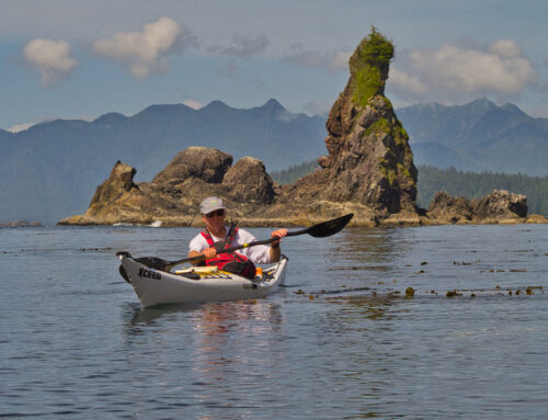
It’s about 5 nautical miles across Quatsino Sound to the Rowley Reefs, a jumble of small rocky islets and reefs just off the southern edge of the sound. An early morning start is always a good idea for long crossings on this coast as the winds will often rise through the afternoon. The Rowley Reefs are a stunningly beautiful area and there are lots of sea otters in the waters here. Once we were through the reefs we pulled into a cove on the east side of a small peninsula on the mainland to take a break and have some lunch. After our meal, we made our way west towards Reckless Bight, our campsite for the night located just inside Kwakiutl Point.
Reckless Bight
There is a large sandy beach on the east side of Kwakiutl Point and good beach camping. We set up camp in mostly clear skies but pretty windy conditions. After dinner we hiked out onto the point as the sun was beginning to go down. We were rewarded with some stunning west coast scenery lit by the low setting sun and a spectacular view north across Quatsino Sound.
Reckless Bight to Lawn Point and on to Side Bay
The weather continued to hold for us as we packed up to leave in the morning, which was fortunate as the waters off Kwakiutl and Lawn Points can be seriously intimidating in bad weather. There were a lot of small islets and reefs to skirt around as we rounded Kwakiutl Point and even with light winds the large swell breaking over the offshore reefs and rebounding off the shore made for some challenging paddling! After rounding the Kwakiutl Point we paddled another couple of miles to Lawn Point where we landed for a break and some exploration.
Lawn Point is aptly named and is a little unusual for this coast. It is a large flat spit of land covered with dune grass leading back into an old-growth forest. From a distance it looks like a manicured golf course, but once you’re there you find out it is waist high dune grass. Lawn Point is a a provincial park, but as appealing as it looks for a place to camp we had other plans for more sheltered camping around the corner in Side Bay.
Side Bay
Side Bay would be the furthest south we planned to to travel on this trip. There is a very large beach at the head of the bay which has road access, so you can find vehicles & RV’s camped here. (We would use this road access to leave the coast on our aborted Brooks Peninsula trip a few years later). We chose a small sheltered beach on the north shore further in the bay to avoid the congestion on the main beach and enjoyed a pleasant, sunny evening for the most part. At sunset we could see that some fog was beginning to form.
Side Bay back to the Rowley Reefs
The fog persisted overnight and was still around as we departed Side Bay for our return north around Lawn and Kwakiutl Points. It was quite a contrast from the previous day’s sunshine, but it is always interesting to see this coast in its different moods. Once again we stopped at Lawn Point for a break before continuing out and around the headland. While the winds remained calm, the seas were quite confused off the point. Our destination for the day was the Rowley Reefs for our last nights camp before crossing Quatsino Sound and back into Winter Harbour.
There are lots of sea otters around the reefs off Restless Bight and the Rowley Reefs. You usually see them hanging out in the kelp beds, often in large rafts. Once we got back to the Rowley Reefs we found a small beach on one of the islets which would give us a good campsite above the high tide line for the night.
Rowley Reefs to Winter Harbour
We were once again rewarded with a great morning for for crossing Quatsino Sound. The skies were overcast with banks of fog drifting about, but there were signs that the sun was trying to break through. The interesting light created by the fog and overcast made for a scenic and very pleasant crossing of the sound. Our target was Forward Inlet on the east side of Kain’s Point which would lead us up to Winter Harbour where our vehicle was waiting.
Winter Harbour
The village of Winter Harbour got its name in the 1800’s, when its sheltered harbour became a haven for sailing ships. The village is a mixture of scattered homes, cottages and various business uses and is home to a sport fishing fleet. An old wooden boardwalk runs the length of the waterfront, a leftover from the days before there was road access to the community.
On arrival in Winter Harbour we would tie up to the government dock to unload the kayaks and head off in search of the van. Fortunately, Winter Harbour is not a large place, so it didn’t take too long to track it down. Other than ending up with a flat tire, likely damaged on gravel roads, the trip home was uneventful.
More Pictures
If you would like to see more pictures of this trip, or purchase images for publications, websites display etc, check out our Quatsino Sound Gallery at our sister website: Brakelightfoto
Map
[/fusion_text][/fusion_builder_column][/fusion_builder_row][/fusion_builder_container]


Cool trip, and great pictures. Thanks!