SOUTH KLONDIKE HWY FROM WHITEHORSE TO CARCROSS AND SKAGWAY, AK
Approximately 12 miles (19 kms) southeast of Whitehorse lies the junction of the Alaska Hwy and the South Klondike Highway that leads to Skagway, Alaska.
This historic route somewhat follows the route used by prospectors in the 1898 Gold Rush. The nickname of ‘Dead Horse Trail’ came about from the hundreds of inexperienced stampeders trying to load up horses with supplies to take them over the White Pass Trail. The trail turned into a quagmire in the rain of the fall of 1897 and this, coupled with the lack of food for the horses and their general poor health caused over 3,000 of the poor animals to die on the trail leaving carcasses strewn everywhere!
Vegetation here consists mostly of jack and lodgepole pine and follows the base of the Caribou Mountain. You’ll see views of Montana Mountain to the south, Caribou Mountain to the east and Gray Ridge Range to the west.
You’ll pass by numerous lakes along the way … but none more spectacular than Emerald Lake (sometimes called ‘Rainbow Lake’) at around 40 kms from the junction. The green/rainbow-like colours are a result of blue-green light waves reflecting off the white sediment of the lake bottom. This white sediment – called ‘marl’ – consists of bits of decomposed shell fragments mixed with clay; it is usually found in shallow, freshwater lakes that have low oxygen levels during the summer months. (See our post on Boya Lake to see another example of the effects of marl.) This is a beautiful place to get out onto the large pull-out and stretch your legs as you marvel at the sight!
At about 50 kms along you’ll find a another most interesting sight … a desert – often referred to as the “world’s smallest desert.” Carcross Desert is commonly referred to as a desert, however it is actually a series of sand dunes.
The area’s climate is too humid to be considered a true desert. The sand was formed during the last glacial period, when large glacial lakes formed and deposited silt. When the lakes dried, the dunes were left behind. Today, sand comes mainly from nearby Bennett Lake, carried by wind. The dunes contain a wide variety of plants, including unusual varieties such as Baikal sedge and Yukon lupine, among others.
The dunes are used by locals for sandboarding. Tourist groups also use the area for off-road scenic tours, which is allowed on the fine-grained dunes. Other summer activities include hiking, skydiving and all-terrain vehicles.
In the winter, the area is used mainly for cross-country skiing and snowboarding.
While we were there we witnessed a number dirt bikes zooming around the dunes and it was surprising that a unique natural feature such as this would allow such traffic. To me it seems like a recipe for a disaster not only to the fragile ecosystem of the dunes, but to the many tourists walking, sitting and/or photographing this beautiful place.
The Yukon Territorial government made efforts to protect Carcross Desert in 1992, but failed due to opposition from locals who use the dunes for recreational purposes.
Hopefully they can try again at some point before it’s too late!
A couple of kilometers further down the road lies the town of Carcross. It was originally known as Caribou Crossing and was named after the migration of huge numbers of caribou that moved across the natural land bridge between Lake Bennett and Nares Lake. That caribou herd was decimated during the Klondike Gold Rush, but a recovery program has now raised the number of animals to about 450.
The modern village began in 1896, during the Klondike Gold Rush. At the time, Caribou Crossing was a popular stopping place for prospectors going to and from the gold fields of Dawson City.
It was no sooner developed to serve Klondike miners than it became an important stopping point for the White Pass & Yukon Railway in September 1898.
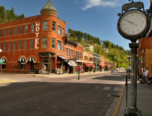
When railway construction through the White Pass was completed, the final gold spike was hammered into the track here on July 29, 1900. For more on the White Pass & Yukon Railway check out our post, click this link. The Caribou Hotel also opened in the same year and still in operation, Matthew Watson’s General Store is the Yukon’s oldest operating store.
During this time passengers and freight would be transferred from rail to stern-wheeler here. For many years the sternwheeler Tutshi stood along the shore of the community, but in July 1990 it was destroyed by fire. The remains of the boat have been converted into a viewing platform along with interpretive displays.
In 1904, Caribou Crossing was renamed Carcross as a result of some mail mix-ups with the Cariboo Regional District in nearby British Columbia.
It is now home to the Carcross/Tagish First Nation. At the 2011 census it had a population of 289.
Recent efforts have established a small ‘village’ within the town that houses first nations artists & performers. There are some beautiful buildings with native images painted on the sides and a totem pole in the centre for performances and gatherings.
There are a few café’s, ice cream shops and coffee shops with picnic tables where you can relax and take in the scenery.
Carcross today relies heavily on tourism to support the local economy. The town offers a variety of historic attractions and outdoor activities and is popular with road traffic including tour buses and RVs. In 2007 the White Pass railway also resumed service to Carcross railway station.
At around kilometer 83 you’ll see the remnants of an old silver mine – The Venus Mine concentrator (private property) which had a capacity of 150 tons per day, but a drop in silver prices caused the mill to close in 1981.
Driving onwards, getting closer to Skagway, you’ll pass through some amazing scenery that some refer to as ‘moonscape’! This strange terrain represents a transition zone between the treed lower elevations and the true alpine above the tree line. The small, twisted alpine firs (also known as ‘mopheads’ are shaped by a combination of heavy snow burying their lower branches and icy winds sculpting their upper branches. Many small ponds dot the landscape as well.
Shortly you’ll be seeing the U.S. border crossing which is about 7 miles from Skagway. Then on to Skagway, Alaska! For more information on Skagway, see our post from our last trip (CLICK HERE) ….. interesting town … not my favorite Alaska town … but still kind of neat.


Leave A Comment